Recent Earthquakes

Earthquakes occur constantly around the globe and intermittently in Ireland. The destructive power of earthquakes is undeniable, causing widespread devastation to communities, infrastructure, and ecosystems. However, studying earthquakes is crucial to mitigating their negative impacts. By understanding the underlying geological processes and fault systems that trigger seismic activity, scientists can develop early warning systems, effective building codes, and improved disaster response strategies

Ballybofey Co.Donegal Ireland 2nd May 2024

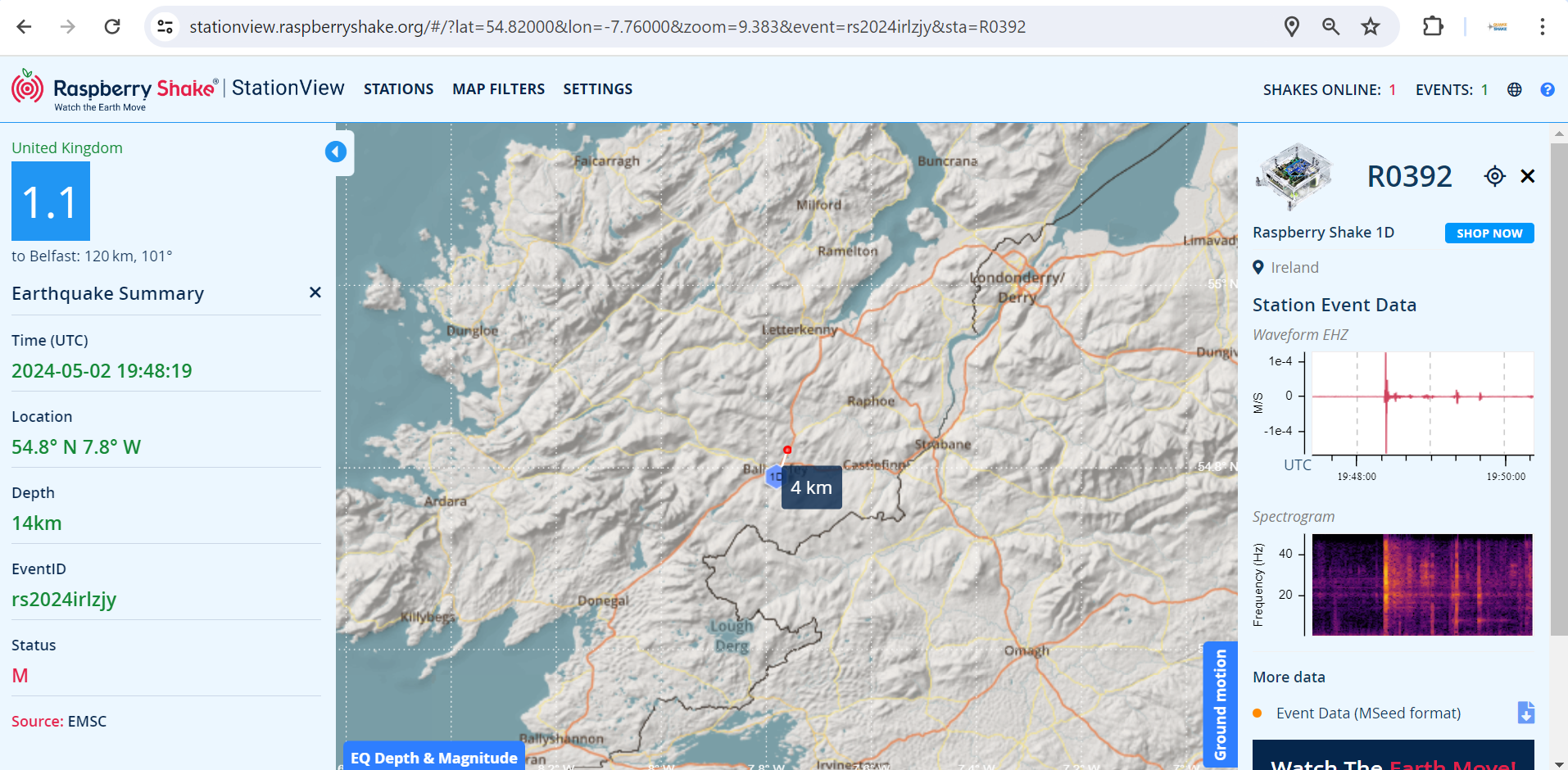
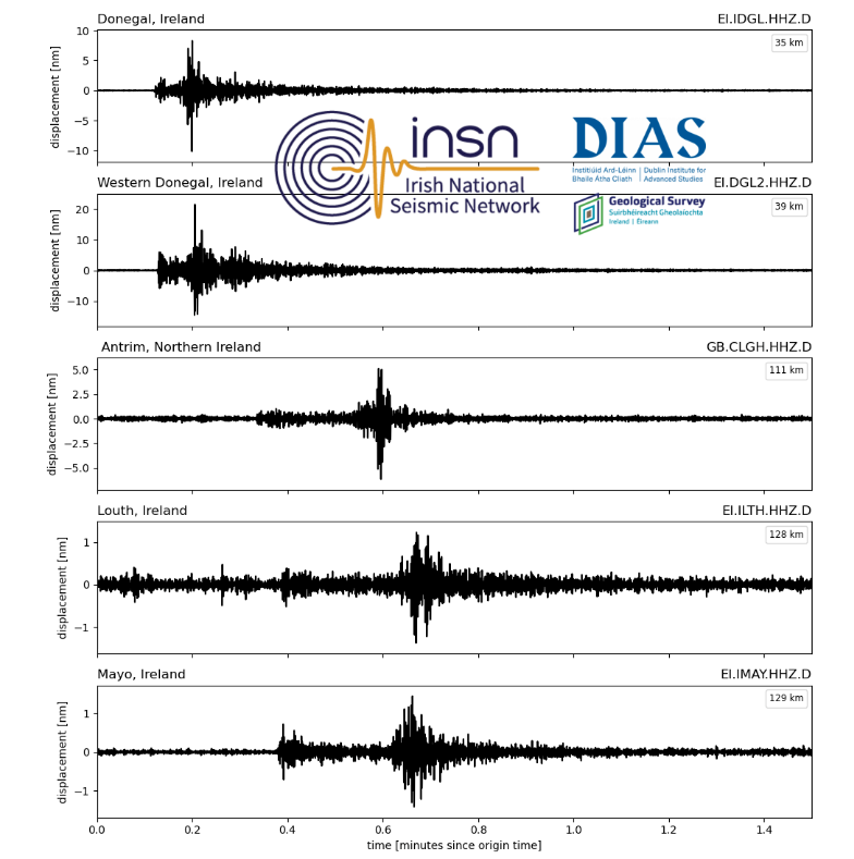
This magnitude 1.1 earthquake occured on the 2nd of May 2024 at 19:48pm local time near Ballybofey in Northern Co. Donegal Ireland 〰️ This earthquake was recorded by a Quake Shake Raspberry Shake seismometer in St.Columbas Secondary School and goes to show our little island can experience earthquakes even though our geographical location is not on the edge of a plate boundary. If you heard 📢or felt this earthquake please let us know by filling in our INSN Felt a Seismic Event questionnaire.

These figures show the magnitude 1.1 earthquake recorded by Quake Shake station R0392 and INSN stations around Ireland.

Honshu, Japan 1st January 2024

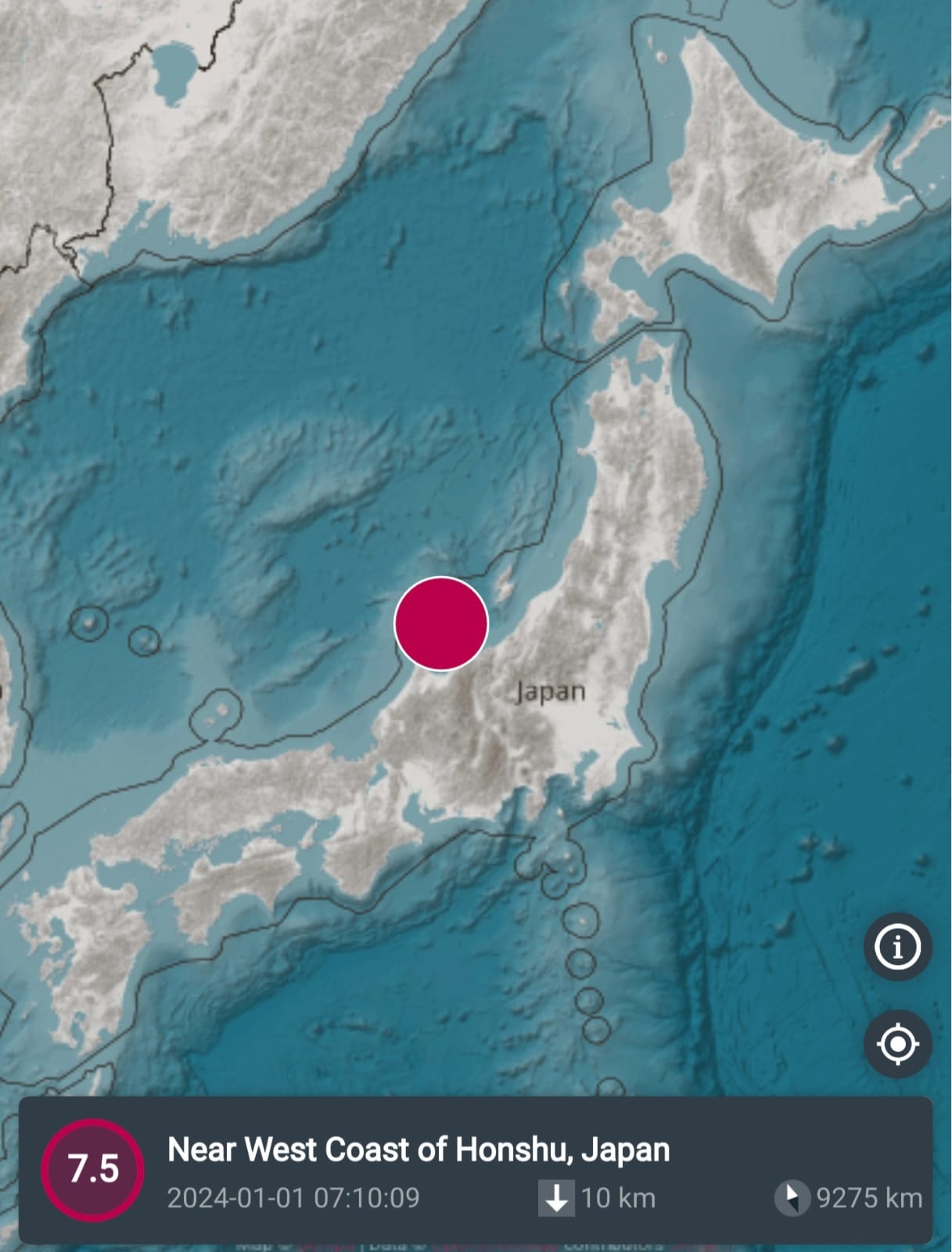
This magnitude 7.5 earthquake occurred at a depth of approximately 10 km. Japan experiences high seismic activity due to the subduction of the Pacific Plate beneath its eastern coast. However, this recent event occurred along the less seismically active western coast, where certain shallow faults accommodate broader plate movements. Shallow earthquakes, such as this one, typically lead to more pronounced surface ground shaking compared to deeper earthquakes, as the energy is released closer to the Earth’s surface.

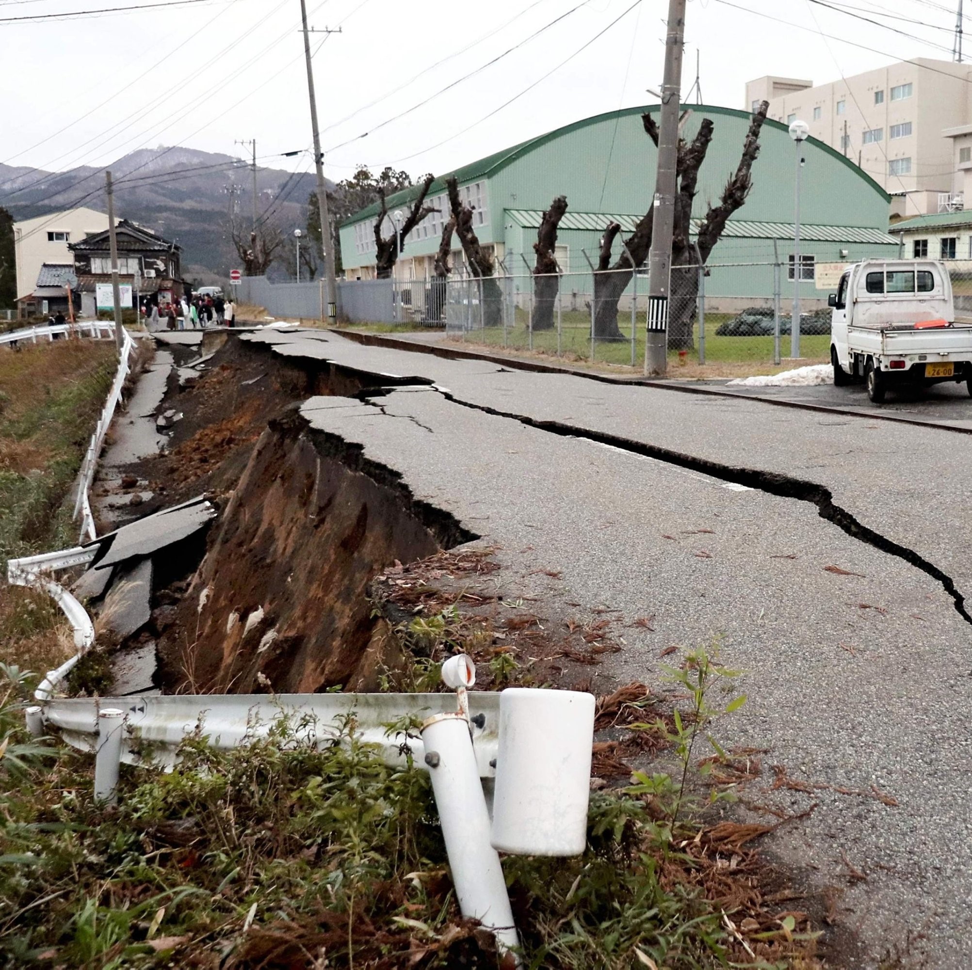
This figure shows damage caused by the earthquake. (Photo by Yusuke Fukuhara / Yomiuri Shimbun via AFP)

The earthquake caused up to intensity IX shaking (violent) on the Noto Peninsula. This intense shaking, caused buildings to collapse and triggered liquefaction and landsliding. Slip on the fault uplifted land and the seafloor, exposing new swaths of coastline and initiating a tsunami, with wave height reaching 3m. A tsunami warning was triggered and later downgraded as Japan has previously experienced a devastating tsunami in 2011 triggered by the M9.1 Tohoku-Oki earthquake. This earthquake generated a tsunami with a maximum wave height of almost 40 meters (130 feet) in the Iwate Prefecture. Researchers also determined that a 2,000-kilometer (1,242-mile) stretch of Japan’s Pacific coast was impacted by the 2011 tsunami.

This figure shows the magnitude 7.5 Honshu earthquake on the Raspberry Shake Shakenet App.

Qinghai Provence, China Earthquake, 18th December 2023

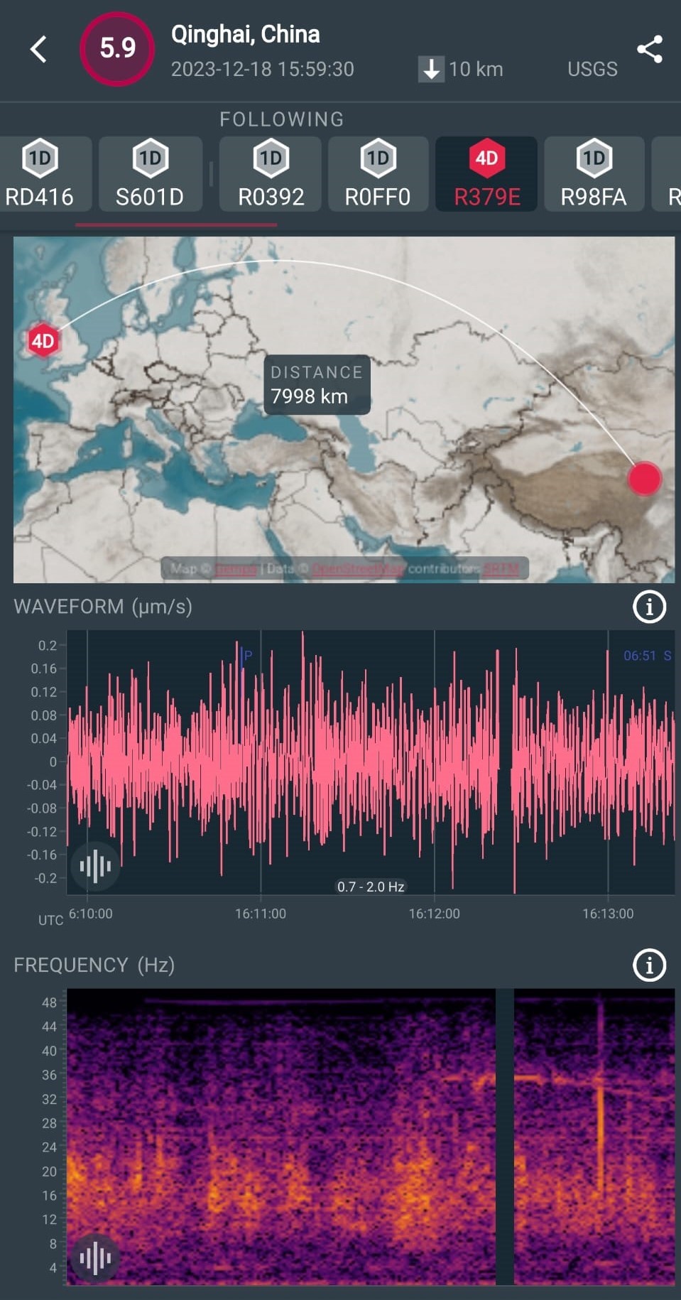
This is the magnitude 5.9 earthquake in north-central China earthquake from December 18th 2023 . The earthquake struck in the Gansu-Qinghai border region which is in north-central China. The Gansu province is within an intraplate region, but situated on the north-eastern margin of the tectonically active Tibetan Plateau. Seismicity in the Tibetan Plateau largely results from the continental collision of the India and Eurasia plates. The earthquake occurred on either a north-striking, steeply dipping, reverse fault or a south-southeast striking, shallowing-dipping, reverse fault. Thousands have been injured and more than 120 fatalities.

This figure shows the M5.9 earthquake recorded by a citizen Raspberry Shake seismometer Station R379E located nearly 8,000km away from the earthquake.
Fanad Pennsinsula Co. Donegal, Ireland 10th December 2023

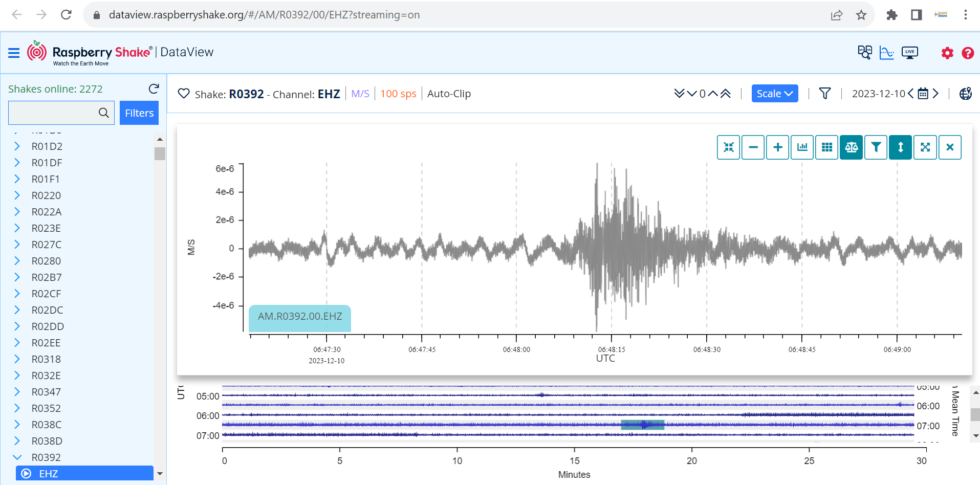
This magnitude 1.3 earthquake was recorded by Raspberry Shake seismometers and by the Irish National Seismic Network (INSN) at 06:48:00 UTC on the 10th of December 2023 . The earthquake occurred at a depth of approximately 5 km, and the epicentre was approximately 5 km east of Kerrykeel. INSN has received several reports that the earthquake was experienced by members of the public near Kerrykeel, whereby most stated that they heard a loud, thunder-like noise. The Fanad peninsula experiences regular seismic activity; the most recent earthquake to occur near Kerrykeel was M1.4 in August 2017, and the largest earthquake on the Fanad peninsula was M2.4 in January 2012.

This figure shows the magnitude 1.3 Donegal earthquake recorded by a citizen Raspberry Shake station R0392.

South West Iceland, Ongoing seismicity 2023

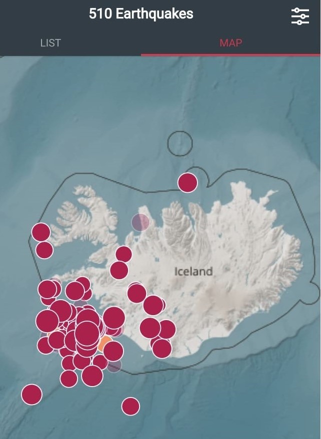
Iceland experienced a series of seismicity swarms, characterized by clusters of frequent (thousands) and relatively small earthquakes. These swarms were indicative of heightened magmatic activity beneath the Earth's surface. Iceland is located along the Mid-Atlantic Ridge, where the North American and Eurasian tectonic plates diverge. The seismicity swarms were closely monitored by Icelandic seismologists at the Icelandic Met Office (IMO). They provide daily seismic updates. The largest magnitude earthquake so far was a magntude 5.3 on the 10th of November. This figure shows 510 earthquakes recorded from the Shake Net app on the 11th of November.

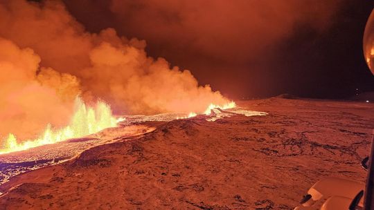
Grindavik, a town with a population of approximately 3,300, sits on the Reykjanes Peninsula, about 31 miles south west of the capital, Grindavik was evacuated on the 10th of November. An eruption began on December 18th. On the 19th of December The Icelandic Met Office said " The development of the eruption is similar to recent eruptions at Fagradalsfjall, where the fissures are starting to contract and form individual eruption vents. Presently, there are about five eruption vents spread along the original fissure. According to information from scientists who went on a second helicopter flight with the Icelandic Coast Guard at around 04:00 UTC today, the total length of the fissure eruption has not changed much from the beginning. There was little activity at the southern end of the fissure near Hagafell, and the majority of the lava flow is heading east towards Fagradalsfjall. Two streams reach west, both north of Stóra-Skógfell."

Herat, Afghanistan  Earthquake October 7 2023

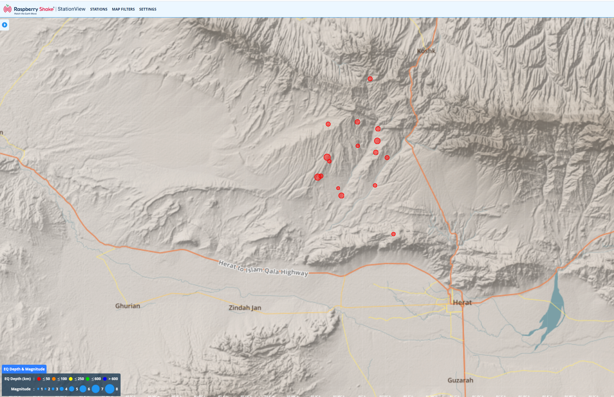
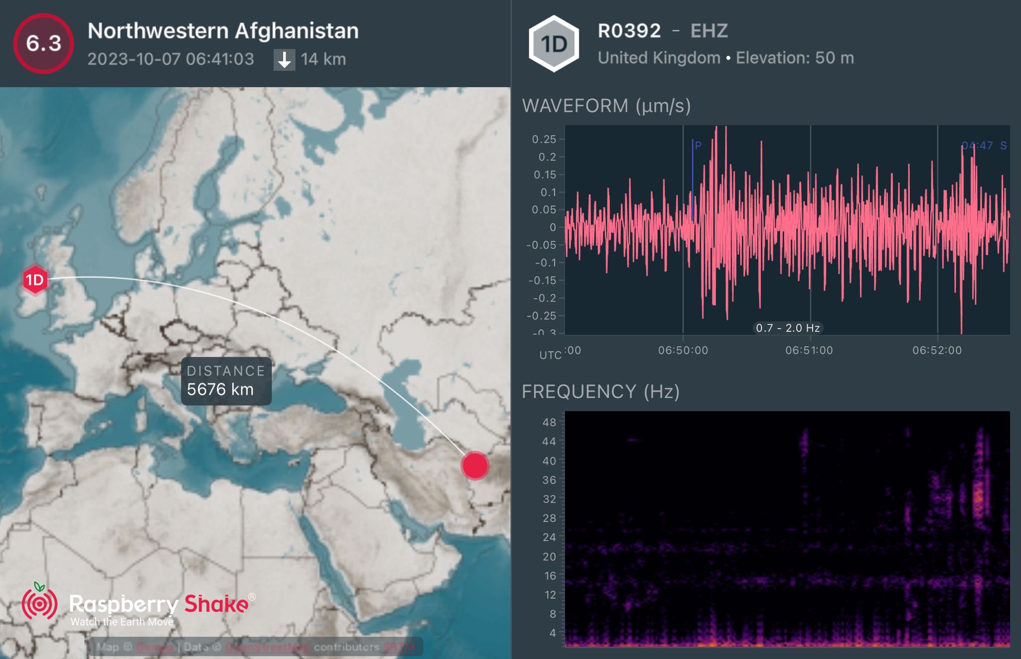
This last earthquake is the recent October 7, 2023, Mag 6.3 earthquake near Herat, Afghanistan. This occurred as the result of thrust faulting at shallow depths near the far western terminus of the Hindu Kush mountain range. This earthquake was followed by a second Mag 6.3 earthquake that occurred approximately 30 minutes later. Both earthquakes occurred on east-west striking fault planes that dip to either the north or south. The earthquakes occurred within the Eurasia plate in an intracontinental mountain belt. Earthquakes in Afghanistan and its surrounding regions are common due to the complex and active interactions between the Arabia, Eurasia, and India plates. Source USGS. Widespread distribution of faults, construction styles and environmental factors were major factor in the vulnerability of rural populations in Afghanistan. Houses and buildings have thick mud roofs supported by timber and walls made of mud brick or stone blocks cemented with dried mud. Unfortunately, they are prone to collapse during shaking events, leading to high fatality rates. Thirdly, the environment plays a significant role in making a place vulnerable to earthquakes.

These figures show the location from the Raspberry Shake Shake Net app and the earthquake recorded by a citizen Raspberry Shake seismometer 5,676km away from Ireland.

High Atlas Morocco Earthquake, 8th September 2023

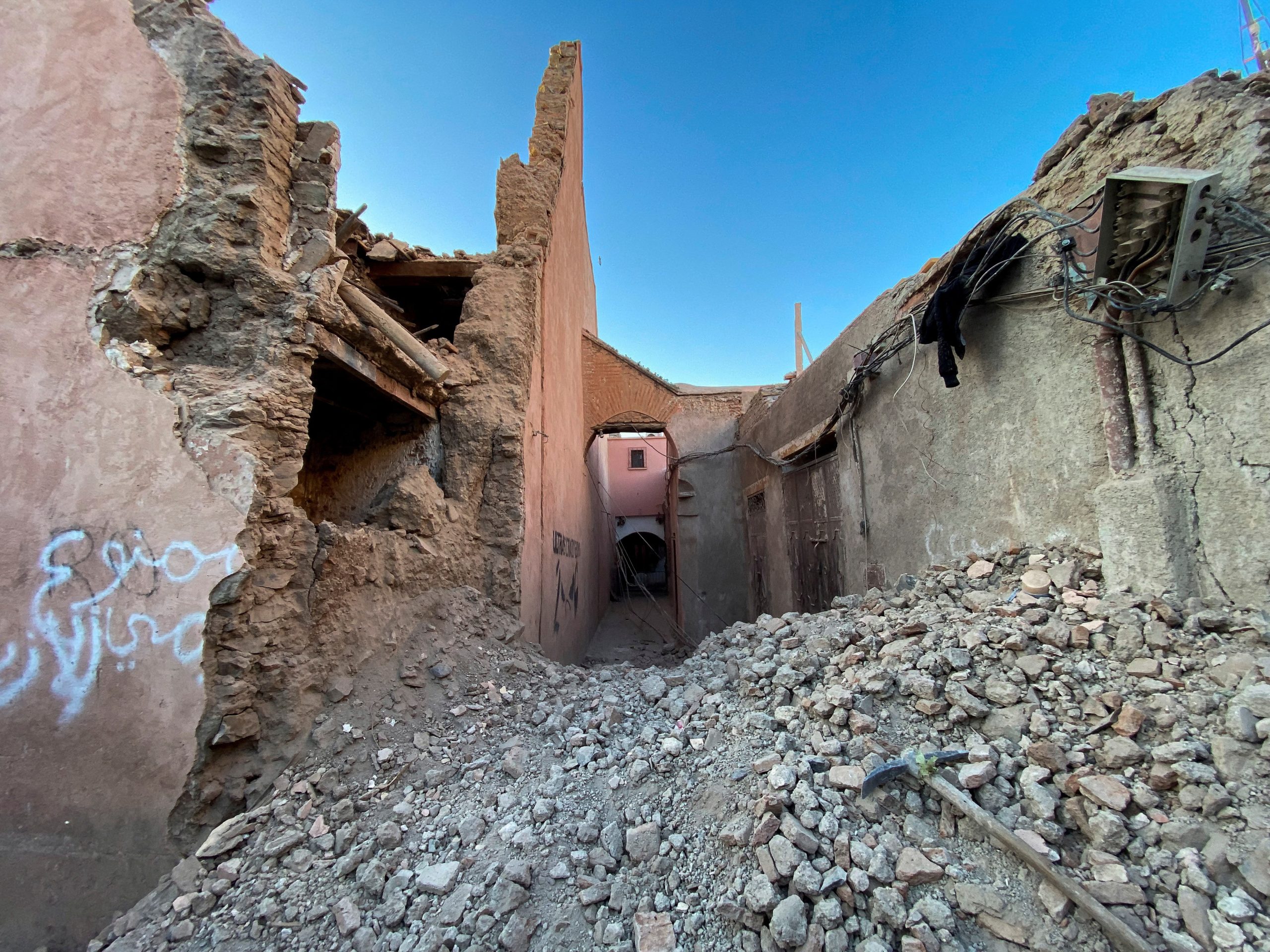
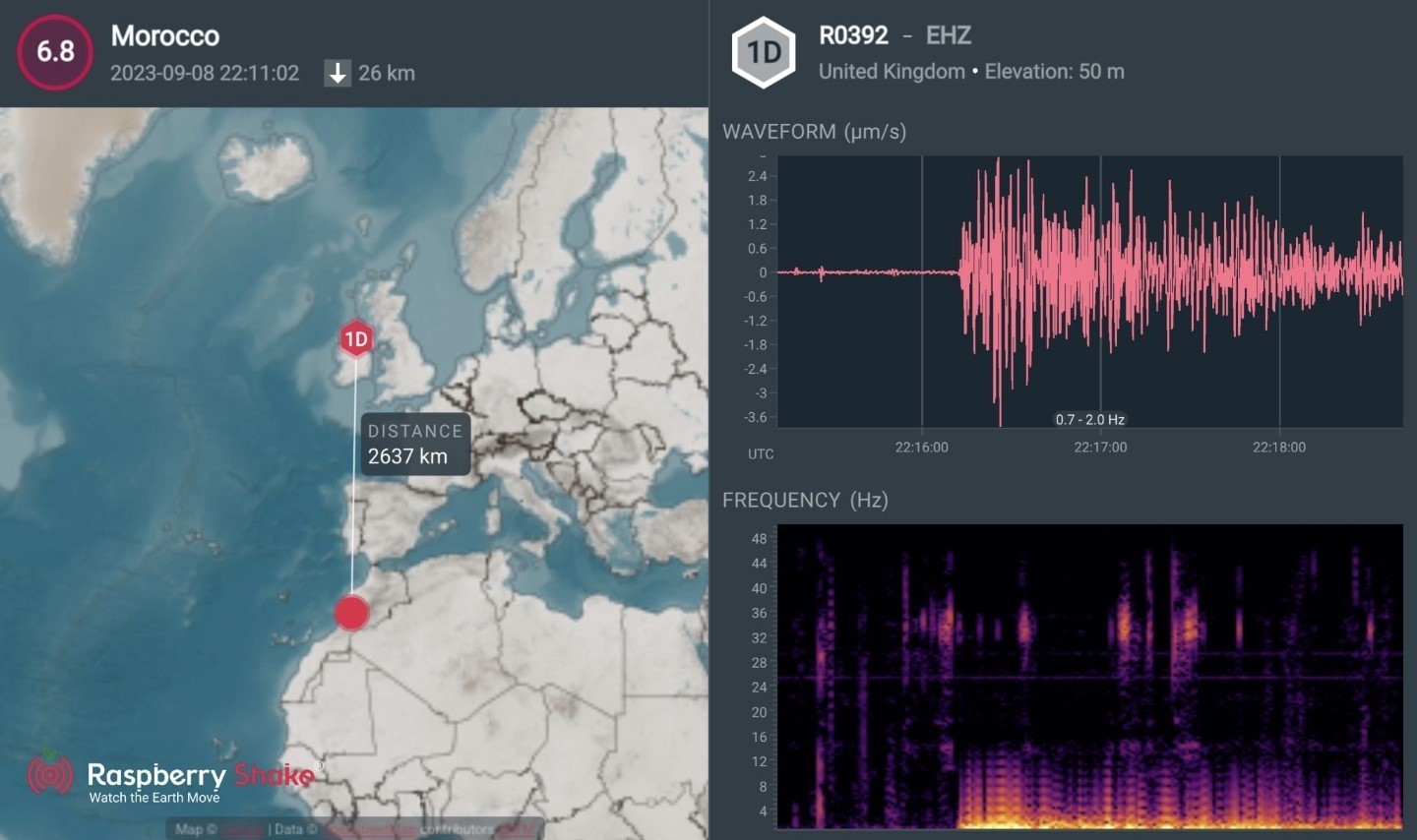
This is the Magnitude 6.8 Morocco earthquake from the 8th of September 2023 . This occurred near Oukaïmedene, due to oblique-reverse faulting at shallow depth within the Moroccan High Atlas Mountain range, roughly 75 km southwest of Marrakech. The High Atlas Mountains contain a variety of mapped strike-slip and thrust faults, trending to the east-west and northeast-southwest. This earthquake occurred within the Africa Plate, approximately 550 km south of the plate boundary between the Africa and Eurasia plates. At the location of this earthquake, the African plate moves approximately 3.6 mm/year WSW relative to the Eurasia plate. Earthquakes of this size in the region are uncommon but not unexpected. Since 1900 there have been nine magnitude 5 or larger earthquakes within 500 km of this event, none of which are over magnitude 6. Source USGS.

This figure shows magnitude 6.8 Morocco earthquake recorded by a citizen Raspberry Shake station R0392.

Glenveagh National Park, Co. Donegal, Ireland May 2023

This magnitude 2.5 earthquake is the largest onshore Irish earthquake recorded by the INSN since its inception. The event was largely felt across western and central Donegal, particularly in Letterkenny, Ballybofey and Dungloe. The INSN received nearly 300 felt reports from members of the public in the days following the earthquake, whereby approximately 85% of respondents heard the earthquake, 76% felt the earthquake, and 32% were awakened by the earthquake. Some respondents reported a duration for the noise they had heard, which was approximately 20 seconds on average. Several commonly occurring descriptions of the earthquake include ”loud rumbling”, ”loud noise”, ”like thunder, but went on too long”, ”like thunder, but deeper and omnidirectional”, with most reporting weak to mild shaking and objects rattling indoors.

This figure shows the 6th of May magnitude 2.5 Donegal earthquake recorded by a citizen Raspberry Shake station RF7A3.